
The Lighthouse
22 years ago we were looking for a home on the Texas coast. We had a 44' Ketch with a 6 foot draft. I needed a home with a slip on the water that could hold the “Millennium Falcon”. I told the real estate agent my requirements and after a week of searching she said, “That's all I have”. Then the next day she called to tell me of one more house I might be interested in. I asked if it had a 6 foot deep slip in the front yard and she said,”No” and I said, “Not interested.” “But its on the highest point on the gulf coast of the United States”, she added. I Immediately responded, “NOW, I am interested.” Within days we bought it. The selling point was a USC&G benchmark 20 feet from the bedroom window that proclaimed it as “the highest point on a salt washed bluff between Key West Florida and Mexico.”
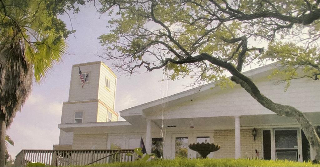
Around the site of the marker, that was set in 1860, were the remains of three metal tower legs that at one time held a light marker for navigation. According to research, this light was half way between the old lighthouse that sat atop the cliff in downtown Corpus Christi and the light that originally marked the pass into Corpus Christi bay. That light is now known as the HEB lighthouse as it is now owned by the HEB family. It no longer marks the entrance to the bay because the pass has shifted over the years until it is much further south. The distance between the two lighthouses is 18 miles and the halfway point was directly over the north end of my NEW house. But that point is 90 feet from the marker. So we built a Lighthouse tower, and named it Monte Christo Light, on the end of the house (where it should have been). Months later, digging a garden I found what was most likely the light that was on top of that metal tower. It has been placed atop the Monte Christo Light tower. So now we have a proper Lighthouse at the proper location.
The Spring
At the bottom of the hill below the lighthouse is a freshwater seep that, in wet weather, fills the ditch with what was once fresh water that was sought after by the sailing ships that frequented the bay. It is now brackish because of the cutting of the La Quinta Channel in the early 1950's. Cutting that channel cut through the clay bottom of the bay and allowed saltwater to contaminate the freshwater below the clay. It is still drinkable, but the salt content can be tasted.
Before 1900 sailing ships would pull up onto what is now my front lawn and fill their freshwater tanks.
 The Beginnings